Wednesday, October 31, 2012

What's Scarier Than Ghouls & Goblins?

Anadarko Drilling Near Rock Run!  


Calm your fears: send an email to DCNR Secretary Richard Alan (cyntthomas@pa.gov) asking him to keep Anadarko OUT of the Clarence Moore tract. You can snail-mail him at:

Richard J. Allan, Secretary
Department of Conservation & Natural Resources
P.O. Box 8767
Harrisburg, PA 17105

Happy (belated) Halloween from RDA! And thanks to member Mary Howe for carving such a stellar pumpkin.

Friday, October 19, 2012

Frozen Run Gorge- a hidden gem of the Loyalsock


The beauty of the Loyalsock State Forest is not limited to Rock Run or the Old Loggers Path.  A few years ago I ventured into the isolated western edge of the state forest.  It was a searing hot June day as the deep green foliage simmered through the haze.  I drove my car up the long, dirt road on Bodine Mountain where I passed a large drilling operation.  The workers just stared at me as my car crested the mountain.

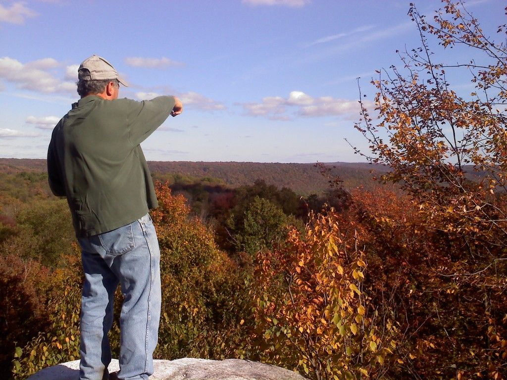
I headed north along the baked ridge, passing a beautiful view to the south.  I reached a small dirt parking area.  I stopped, but my goal was still far away.  I was determined to explore the lonely, isolated Frozen Run Gorge.

I found a small tributary as it cascaded down a rugged glen with boulders and small waterfalls.  I battled through brush and crouched under hemlocks.  Sweat crept down my skin and drowned my brow.  The water danced down the gradient as I carefully descended the glen.  I found an old logging grade and I reached Frozen Run.

This esoteric stream flowed under towering hardwoods as its clear current parsed the forest.  I first hiked upstream, passing a creek clogged with large boulders separated by crystalline pools.  The clear water fell with gowns of white that glistened in the unrelenting sun.  Frozen Run took a tortured course over ledges and between boulders, creating a place of impressive beauty.

I reversed course and hiked downstream, finding another old woods road.  The creek lept from boulder to boulder.  To my surprise, there was virtually no stinging nettle in the gorge.  The creek became constricted and massive boulders crowned the rim.  I reached Boulder Falls, a place of sublime wonder.

                                                       Boulder Falls, Frozen Run Gorge

The massive white boulders were perched in improbable positions on the crest of the ledge that created the falls.  At the foot of the falls was a large pool.  I've seen many special places, but to see one that few others have experienced made it especially memorable.  The falls are not very high, but its setting is unlike any I've seen in the state forest.

I continued down the creek, as it fell away along a steep gradient of boulders.  I couldn't imagine what it must be like with high water.  The roar down the gorge would be deafening.  I continued my trek and I reached a stunning mini-gorge with waterslides and cascades that swirled into a deep aquamarine pool guarded by red ledges and lime-colored ferns.  I retraced my steps at a private property line.  I was amazed and fulfilled by what I had seen; I remember thinking this gorge should be a state forest natural or wild area.

I have not been back since; I can only hope Frozen Run Gorge has retained its magic.  I've heard there may be drilling in its headwaters.  Regardless, make the effort to visit this secret, hidden wonder.  It isolation and beauty will make you treasure this place we call home.

Speak Up


The Williamsport Sun-Gazette published an article about gas drilling in Rock Run in today's newspaper. 

Since DCNR still won't hold a public meeting about Anadarko's development plans, let's speak up in the comments section. Better yet, write a Letter to the Editor

Remember, one that speaks up is louder than 1,000 who remain silent.

Friday, October 12, 2012

Pitcher Plants


The bizarre and beautiful carnivorous pitcher plant grows discreetly in the Clarence Moore tract of the Loyalsock State Forest. Pitcher plants are rare and sensitive. Should Anadarko drilling operations really be allowed near them?

Please 
tell Governor Corbett to protect the Clarence Moore tract from Anadarko development. Call him at 717-787-2500 or write to him at Governor@pa.gov


Please act today because tomorrow may be too late.

DCNR & Anadarko Finally Acknowledge Plans For Drilling Old Loggers Path


It may be our State Forest, but it took a Philadelphia reporter to get DCNR to finally admit that Loyalsock State Forest’s  Rock Run / Old Loggers Path / Masten Ghost Town areas are slated for gas development – and without public input. 
"DCNR has given us permission to perform preliminary survey studies, which includes staking the area to show where development locations could be and guide our environmental assessment of the area," states Mary B. Wolf, an Anadarko spokeswoman.
Activists push Pa. to restrict drilling in tract

By Andrew Maykuth
Inquirer Staff Writer
Tuesday, October 9, 2012


Environmental activists are pressuring the state to restrict Marcellus Shale drilling on 18,780 acres in a popular recreational area of northern Pennsylvania, where they say the state has a rare opportunity to control natural-gas extraction because of a 1933 deed restriction.

The Department of Conservation and Natural Resources is being pressed to put the brakes on gas development in the Loyalsock State Forest, where an exploration company has begun staking out drilling locations near the Old Loggers Path, a 27-mile loop trail that DCNR says "offers stunning vistas and clear, cold, cascading streams."

Six organizations, including Citizens for Pennsylvania's Future, say the state has rebuffed their requests to disclose drilling plans for the forest. They received no response from DCNR Secretary Richard J. Allan to a Sept. 7 letter calling on the agency to hold public hearings on the drilling plans.

"There is no precedent for holding a public meeting on a development plan," Chris Novak, the agency's spokeswoman, said in an e-mail. She said that no drilling has been approved for the disputed area in Lycoming and Sullivan Counties.

Anadarko Petroleum Corp., of Woodlands, Texas, which owns or leases the mineral rights under the forest, acknowledged that it had been in discussions with the state over developing the Loyalsock.
"DCNR has given us permission to perform preliminary survey studies, which includes staking the area to show where development locations could be and guide our environmental assessment of the area," Mary B. Wolf, an Anadarko spokeswoman, said in an e-mail.

DCNR itself has touted the area, which includes the Rock Run stream, as exceptional. "Few streams in Pennsylvania can match Rock Run's rich tapestry of deep, crystal-clear pools, cascading waterfalls and massive, weathered rock formations," an agency official said in a 2008 DCNR news release.

The environmental groups complain that DCNR's caginess reflects the Corbett administration's favoritism toward development of the Marcellus Shale, which the governor regards as the cornerstone of a rejuvenated Pennsylvania energy industry.

"This is kind of emblematic of the administration's approach to the public," said Richard Martin, coordinator of the Pennsylvania Forest Coalition, which has urged its members to write to DCNR's Allan.
Loyalsock State Forest lies above some of the most productive land in the Marcellus Shale, which has been generating a growing income for Harrisburg. About 725,000 of the state's 2.1 million acres of forests have been leased for gas development.

Marcellus Shale royalties quadrupled from $10.7 million in 2010 to $41.8 million last year. Through August of this year, the state has generated $41.5 million in royalties from Marcellus wells, matching last year's income in the first eight months of 2012. But the state earns no royalties on 290,000 acres of state forest under which it does not own the mineral rights. That includes several substantial tracts of the Loyalsock.

The state typically would have little control over drilling activity on land where it does not own the mineral rights. Courts have ruled consistently that mineral rights trump surface rights - the sub-surface owner needs access to the land in order to mine or drill the minerals.
But environmental groups say that an unusual covenant in the deed to 18,780 acres of the Loyalsock gives the state uncommon power to control the surface activity.
In 1933, the Central Pennsylvania Lumber Co. sold the land to the state and kept the "mineral estate" for itself. The deed allowed the owner of the mineral rights access to the surface for 50 years.

In the 1980s, after the 50-year-provision expired, the state asserted that the mineral rights reverted to the state. But the Commonwealth Court in 1989 ruled that the mineral rights belonged to the current owner, a man named Clarence Moore. Moore still owned the mineral rights, but he no longer had surface access - the rights had expired in 1983.
The ruling was reaffirmed in 1999 by the Pennsylvania Board of Claims.
Moore later sold ownership of the mineral rights, which is now split between Anadarko and International Development Corp. IDC has leased its interest to Southwestern Energy Co.

Environmental groups discovered the provisions while researching the deeds in the Lycoming County Courthouse, said Ralph Kisberg, the president of the Responsible Drilling Alliance in Williamsport.
Mark Szybist, a PennFuture lawyer, said that the state could use the deed restrictions to force Anadarko to reduce the disturbance to the sensitive forests in exchange for surface access. Anadarko could also use horizontal drilling techniques to access the property from adjacent land it is leasing.
"We're saying these are public lands and the public should have a say in how those lands will be used," Szybist said.

DCNR says the issue is not open to discussion.

"It is DCNR's job to balance the many uses of our state forest lands, including recreational uses and mineral extraction," Novak said. "As you know, our state forests are independently certified as well-managed, and that acknowledges that we do a pretty good job balancing uses and protecting the future health of the public lands."

Anadarko says it, too, is mindful of the area's natural beauty.
"We recognize the importance of public lands in Pennsylvania, including the Loyalsock State Forest," said Wolf, the company's spokeswoman.

"As with all of our operations, and in particular on state forest land, we are looking to minimize surface disturbance and protect special places like Rock Run."

She said Anadarko would continue to work with DCNR and the state Department of Environmental Protection "to communicate approved plans as appropriate." *

* Ed Note:  That could be interpreted as "we'll let you know when it's a 'done deal' and you can't do anything about it".  
As of today it is NOT a done deal. 
It is irresponsible of DCNR to sign any surface access agreement without first studying the area to determine what species of special concern should be protected, and how.
            If you can't measure it, you can't manage it.   It's that simple.
Write to Secretary Allan at rjallan@pa.gov , agingrich@pa.gov , ddevlin@pa.gov , tborawski@pa.gov and cc coalition-secretay@comcast.net and your State Representative and Senator.

Anadarko's Plan For Sullivan Mountain?


We received this map from the PA Forest Coalition and noticed that the coins' placement closely corresponds with stakes we found marking future well pad sites on Sullivan Mountain. Is this Anadarko's development plan for the Clarence Moore tract?

Each coin represents a potential well pad. The coins' surface area is larger than a well pad would be, but the number and distribution remains relevant. That's a lot of impact for such a beautiful, ecologically sensitive area.

Thursday, October 11, 2012

Greedy Business

by Jackie Strosser

I have been camping in an old Civilian Conservation Camp in Masten, in Lycoming County, PA for over 20 years. The camp has quite a long history in my family - my PopPop began visiting there when he came home from WWII. This camp has become a special place in my heart. Being there gave always gave me a feeling of peace & quiet and serenity. Once, I was even blessed to see a mountain lion cross my path a hundred feet from me while in my car. But recently, things have changed. Wildlife is being forced out of their homes and onto roadways and getting killed. The grey mud and the stench of oil is terrible. Old CCC camps & hiking trails are being destroyed due to the gas drillers. Beautiful creeks & streams have been ruined.

The drilling industry has no respect for our Pennsylvanian forests. Instead, all they see are dollar signs. This is a greedy business. Pennsylvania is known for its beauty and natural forests full of mountain laurel, the state flower. It is heartbreaking that this could be taken from us if we don’t fight it. Please don’t allow drilling in our pristine forests!   

Tuesday, October 9, 2012

Petition To Protect The Loyalsock


Click here to sign the petition.

Preserve the beauty of some of Pennsylvania's most pristine areas - put a halt to the destruction of Old Logger's Path!  A get-away in the woods known to locals and tourists alike, is now being threatened by our insatiable greed for fuel. If the drilling planned for this area is allowed to continue, an area once renowned for its isolation and tranquility will become a man-made wasteland. 

Not only could the fracking of Old Logger's Path and the surrounding areas make the trail nearly unexplorable, but the flowing waters of Rock Run, located just outside the trail, will likely become too toxic for any sort of life. Swimming, exploring, learning and escaping will no longer be an option for those who admire this land. Human, plant and animal life will all suffer from this decimation.  Once this area is destroyed, the chances of it ever being returned to it's natural glory are grim.

It is up to us to decide what sort of world the next generation will live in.  Our children, and our children's children should not have to hear stories of what a beautiful planet we once inhabited. They should not have to wonder what clean, natural environments really look like. Wild areas and the safety that they offer is more valuable than oil will ever be.

Keep the planet we were given safe, make your voice heard and stop the toxic development of our last remaining natural havens!

Thursday, October 4, 2012

Proprietary Plans On Public Land


Although Responsible Drilling Alliance has been aware of Anadarko Petroleum Corporation's plans to develop gas rights in and around the Old Loggers Path, Rock Run, Pleasant Stream and other Lycoming and Loyalsock Creek headwater streams for some time now, the plans have yet to be revealed to the public. Apparently such information can be considered “proprietary” despite the fact that the development will take place on public land.

When will this information become public? The people of Pennsylvania deserve the right to offer input on the management of public land before  another insider deal is done. Why don't stakeholders other than the developer and an administration with huge campaign contributions from the gas industry have a seat at the table with the DCNR? A true gem of our public lands is on the chopping block, and no direct benefit to the public - in fact, only detriment - will accrue from shale gas development.

On September 7th, Responsible Drilling Alliance, the PA Forest Coalition, Citizens for Pennsylvania’s Future, the Keystone Trails Association and the Sierra Club sent a letter to DCNR Secretary Richard Allan asking for environmental impact studies, public meetings on development alternatives, and public comment periods on any proposed agreements between DCNR and Anadarko. We have yet to receive a response.

RDA President Ralph Kisberg and PA State Senate candidate Luana Cleveland spoke to a high level DCNR staff person in Harrisburg on Tuesday who denied any talks between DCNR and Anadarko about developing the Clarence Moore tracts.  On Monday, State Rep. Garth Everett told RDA that Anadarko and DCNR are "discussing development of the Clarence Moore tracts". On Wednesday, RDA found stakes for a "preliminary" pad site on a portion of Clarence Moore where maps tell us DCNR controls surface development. We also saw flagging for road widening and the placement of gas and water pipelines.

If Rep. Everett was mislead and there are no disucssions between DCNR and Anadarko, how would the latter be able out a portion of forest that the former has jurisdiction over? Something doesn’t add up.

The stakes and flagging RDA discovered Wednesday are in addition to those found on Crandall Town Trail last week. This new "preliminary" site is along John Merrell Road, about  0.4 miles west from Cascade Road on Burnett’s Ridge.

Well pads around here have typically been constructed following a loose southwest to northeast trend line, with each pad along that line ideally about 1/2 mile apart. By extrapolating this pattern you get a rough idea of Anadarko’s planned layout for the Clarence Moore 25,000 acres of mineral rights. In the case of other developments on large tracts of land, a trend line will emerge approximately every 2 miles to the north and south. The discovery of the sites planned for Burnett’s Ridge and Sullivan Mountain confirms this basic well pad layout pattern, although topographical and water features have modified it somewhat.

The length of some operators' laterals has approached 10,000 feet. By exercising its surface control of ¾ of the Clarence Moore tract, DCNR could force the company to push their trend lines farther apart. This would mitigate surface disturbance to the state forest by about half. If development were delayed for a longer period, hydraulic fracturing technology might evolve to the point where the surface need not be disturbed at all. If the administration were willing to include the public in its negotiations with Anadarko, perhaps this region's beauty, tranquility and decades of forest equity would not be thrown away so easily.

DCNR’s furtive behavior concerning its negotiations with Anadarko does not serve its mission or the interests of the people. Why are surface use plans on public land allowed to be considered proprietary? Why does DCNR deny negotiations with Anadarko when all evidence points to the contrary? Most of all, why is public land being developed without public input?
Photos From Clarence Moore  

Hikers visiting from Philadelphia

Anadarko wants to build a well pad along this trail

Ralph pointing out Potash Mountain and Pleasant Stream drainage

Beautiful fall colors

Alternatives

Vista on Old Loggers Path

Anadarko well pad stake on Burnett Ridge


Wednesday, October 3, 2012

Clarence Moore: Who Controls What


The map above shows who controls the surface use of Clarence Moore tracts in the Loyalsock State Forest. DCNR is highlighted in yellow, and the mineral rights' owner (in this case Anadarko and one other corporation) is highlighted in blue.

The Northeast corner of this particular section of the state forest is missing from the map. The missing portion contains the Devil's Elbow Natural Area, which has headwaters for the North Branch of Rock Run. It also has large marshes and healthy hemlock stands. It is entirely in yellow and therefore, we believe, under DCNR surface control.